

At around 11 p.m. EST tonight, Hurricane Helene made landfall in the Florida panhandle. Popular vacation spots in the panhandle–St. George, Appalachacola, Dog Island, Alligator Point, and Tallahassee–have been and will be pummeled by the storm. Current headlines forewarning the hurricane have already reported the immense size of the “life-threatening” storm surge(s), some of which can tower 20 feet. For reference, a standard beach house’s entire height usually reaches around 25-40 feet.
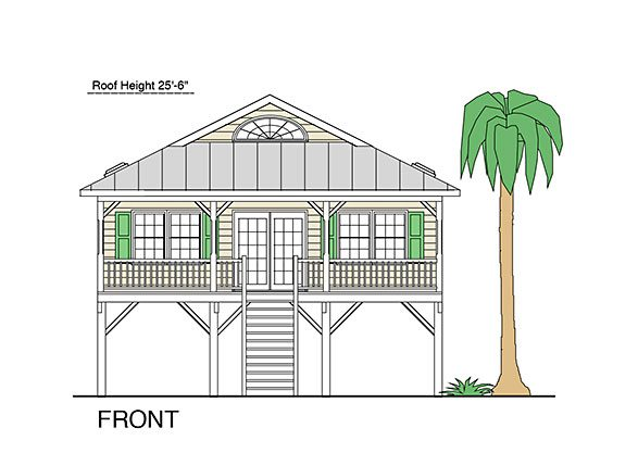
A fairly short beach cottage house stands a measly 25’. Hurricane Helene’s storm surge will almost completely submerge these homes. Image: Coastal Home Plans
Aside from the damages to Florida and other states, Hurricane Helene threatens Kentucky, too. Moving up the interior basin of Alabama and Georgia, Hurricane Helene will maintain some of its power from the Gulf of Mexico. The National Weather Service predicts that it will penetrate Tennessee and make its way into Kentucky, Indiana, and Ohio.
Of course, Transylvania is situated comfortably in the center of the eastern United States. Usually, the Appalachian mountains provide enough of a barrier to prevent storms from reaching Kentucky. Still more usual is the pattern of the Atlantic churning a hurricane to hit eastern Florida, and ride up the Atlantic seaboard. Hurricane Helene will buck the trend to deliver a gut punch to the southeastern portion of the United States. States in the line of its destruction–Alabama, Florida, Georgia, Kentucky, and Tennessee–can all expect high levels of precipitation accompanied by serious wind speeds. Reports vary, but scientists seem to point to increased ocean surface temperatures as the cause of increased hurricane severity and activity. Warm oceans ‘charge’ hurricanes with the power to spin into superstorms; more heat means more power. With enough energy, storms like Hurricane Helene will continue to batter the coasts of the U.S., and push more storms further north into states with little historical preparation for such storms.
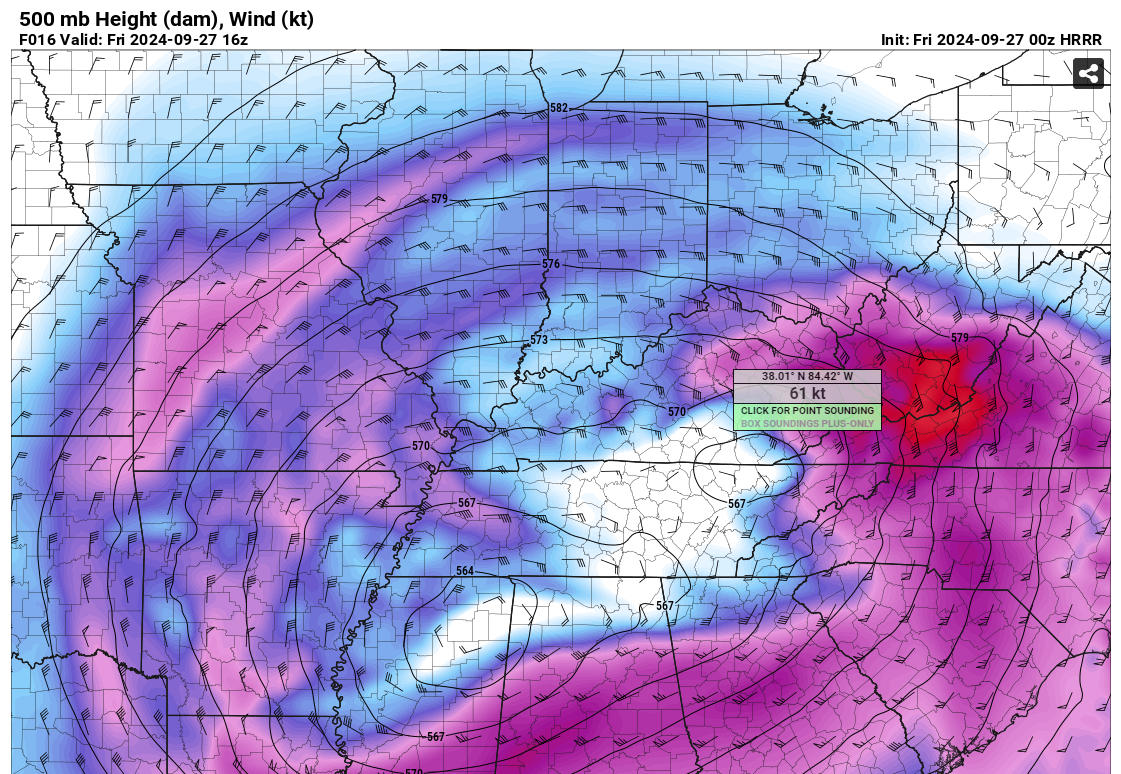
Wind speeds of 61 knots (70 mph) are expected in Fayette Co. around noon tomorrow. Image: PivotWeather
Back in March 2023, a series of storms hit Lexington with around the same wind speeds, knocking out power for much of the city. Driving down Richmond or Man O’ War was all but impossible on account of the tree debris and lack of functioning street lights. The wind from the storm damaged, or completely blew away, roofs all across the central Bluegrass. Here at Transylvania, some dorm buildings went without power due to damage to power lines. Additionally, the rainfall inundated the soil with so much liquid that the root systems of many trees failed to keep themselves rooted against the high wind speeds.

Expected precipitation in some areas close to Fayette Co. climb to 5 to 6 inches of expected rainfall. Image: Chris Bailey via X
Transylvania is positioned in the metropolitan area of Fayette Co. and is thus usually more quickly responded to by emergency services than the surrounding suburbs due to its proximity to emergency services. The National Weather Service put out a wind advisory at just 9:25 p.m. Thursday night, stating “East winds 20 to 30 mph with gusts up to 50 mph [are] expected.” Sustained wind speeds of 20 to 30 mph will weaken power lines and trees, and along with NOAA’s predicted 2 to 4 inches of rain, could spell danger for the Lexington community.
The forecasted weather has set off several alarms, including an announcement by the University of Louisville canceling its Friday classes in lieu of the storm. More information regarding inclement weather can be found at NOAA and the National Weather Service websites.
